Breakwater
details 543
International
Breakwater
Directory
![]()
|
|
Reference documents:
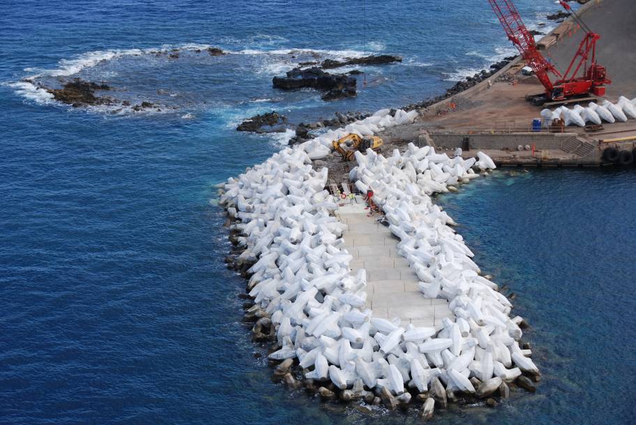
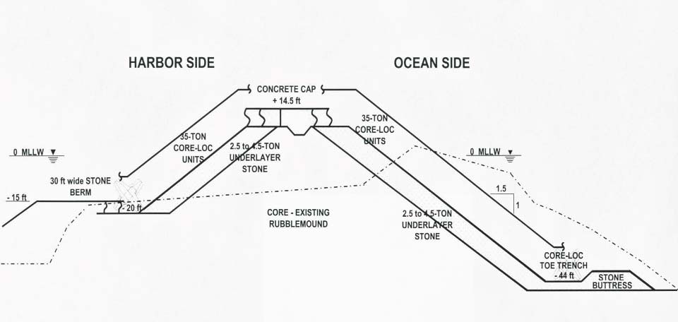
| 2010 - Jessica H. Podoski,ĀGerald W. Bawden,ĀBond Sandra,ĀThomas D. Smith, andĀJames Foster - Post-Construction Monitoring of a Core-Loc Breakwater Using Tripod-Based LiDAR; Coasts, marine structures and breakwaters: Adapting to change. | - - ; |
This is a database prepared by HR Wallingford and TU Delft with the assistance of the international breakwater community and has been made freely available for the benefit of breakwater designers, contractors owners and developers worldwide. The database is subject to regular updating as information becomes available, however the development and maintenance of this database relies primarily on information supplied or published by third parties and no responsibility can be taken for the accuracy of data supplied.